March Maptime - Spatial Data Formats and Data Sources
For our March Maptime, Shaun Walbridge is going to talk all about GeoJSON, TopoJSON, Shapefiles and your other favorite spatial data formats.
Update: The spatial data formats talk is up at https://4326.us/maptime-data-formats, with a full repository up on Github. We also had a few additional tools and formats come up in the discussion:
- csvkit for slicing, dicing, and even joining CSV files (suggested by Sean Sweeney)
- pygeobuf, a protobuf based format for encoding GeoJSON-like streams.
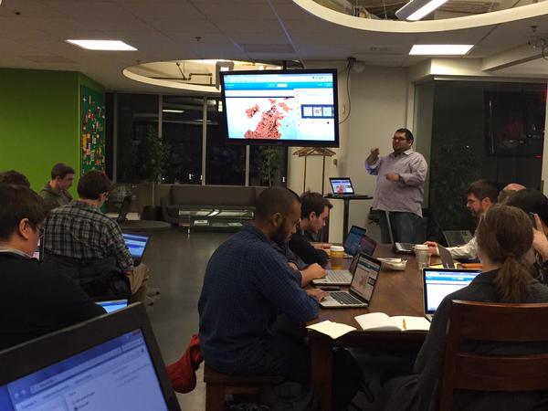
CartoDB is sponsoring Maptime this month and will be buying pizza for us!
Beginners are encouraged, and be sure bring your laptop.
February Maptime - Mapping with D3
Our 2nd Maptime Boston of the year. Come learn about the powerful Javascript library D3 (http://d3js.org/) and its map- and geo-related features.
Update:
The talk slides are here: http://maptimeboston.github.io/d3-maptime/. And do follow some of the additional links within if you’re trying to learn D3; there are a lot of great resources out there.
If you know other good resources or any cool maps that you’ve made or seen, please share!
Beginners are encouraged, and be sure bring your laptop.
January Maptime - CartoDB
Happy New Year Maptime Boston! This is our first event of 2015.
Come learn about CartoDB, a powerful web-based platform for storing, querying, and visualizing your data. Guido Stein will guide us through getting started and some examples.
Beginners are encouraged, and be sure bring your laptop.
November Maptime - Intro to GitHub for Geodata
This will be our 6th Maptime Boston Meetup.
Come learn about using GitHub for your geo-projects. Calvin Metcalf will walk us through GitHub basics and how it can be used for geodata and collaboration.
October Maptime - Show and Tell!
Last week’s Maptime was a show and tell night. A dozen or so people gave short demonstrations or presentations of maps and other projects they’re working on. It was fun to see what everyone is up to, especially when people showed off things they had learned at previous Maptime events!
Abishek presented some reasearch on Who Uses OpenStreetMap. He also shared this map to go along with it.
Jerrad showed two projects: the Camberville Green Map and Ecological Footprint maps.
Tim spoke about his work with Azavea’s Summer of Maps program.
Sean talked about what’s happening with Cambridge GIS data, which is available on GitHub. He also showed a couple of cool maps, including this fall foliage map.
Cristen couldn’t make it but wanted to be sure we were all aware of this fun map.
Ornoth showed his work on a personal cycling heat map. Read more about it here.
Andy sought ideas for good ways to map Hubway bicycle/station availability as an update to an older project.
Jake presented two maps of Cambridge parking ticket data: a heat map and a binned map. He has some code and explanation to go along with them.
Nick showed two maps he made at RunKeeper, analyzing when people run, and speed, distance, and frequency.
Mike gave us a look at a realtime map of shipping vessels, which he is unable to post publicly, but he has shared some code that helps with the realtime mapping.
Guido talked about some of his “quick and dirty” mapping methods for mapping.place.
Thanks to everyone who shared their work! We all look forward to another show and tell night in the future!